![](/images/other/stat-length.png)
![Excursión Carrera La Londe-les-Maures - Course à pied du Lundi 07 janvier 2013 - Photo](https://media.geolcdn.com/t/1900/400/ext.pjpeg?maxdim=2&url=https%3A%2F%2Fstatic1.geolcdn.com%2Fsiteimages%2Fupload%2Ffiles%2F1524743154running.jpg)
Course à pied du Lundi 07 janvier 2013
jerome_83
Usuario
![Longitud](/images/other/stat-length.png)
Longitud
17,6 km
![Altitud máxima](https://static1.geolcdn.com/siteimages/upload/files/1508320355ic_sort_altitude_max_24dp.png)
Altitud máxima
429 m
![Desnivel positivo](https://static1.geolcdn.com/siteimages/upload/files/1508320355ic_sort_den_pos_24dp.png)
Desnivel positivo
717 m
![Km-Effort](/images/other/stat-length.png)
Km-Effort
27 km
![Altitud mínima](https://static1.geolcdn.com/siteimages/upload/files/1508320355ic_sort_altitude_min_24dp.png)
Altitud mínima
91 m
![Desnivel negativo](https://static1.geolcdn.com/siteimages/upload/files/1508320355ic_sort_den_neg_24dp.png)
Desnivel negativo
689 m
![Boucle](https://static1.geolcdn.com/siteimages/upload/files/16400158638029165_repeat_loop_refresh_sync_direction_icon.png)
Boucle
No
Fecha de creación :
2014-12-10 00:00:00.0
Última modificación :
2014-12-10 00:00:00.0
![Carrera](https://static1.geolcdn.com/sitytour/trail-icons/103.png)
2h04
Dificultad : Muy difícil
![Escanee este código QR para abrir la excursión en la aplicación SityTrail](https://capi.geolives.com/qq0zvz2zws4bq2lad0pu/sitytour/trails/165499/qr.png?size=200)
Aplicación GPS de excursión GRATIS
A propósito
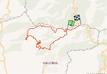
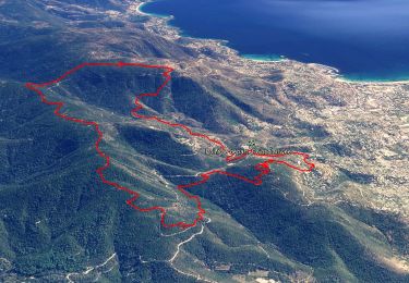
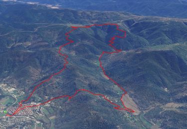
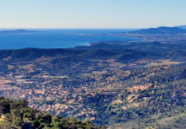
Ruta Carrera de 17,6 km a descubrir en Provenza-Alpes-Costa Azul, Var, La Londe-les-Maures. Esta ruta ha sido propuesta por jerome_83.
Descripción
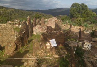
Assez difficile de trouver sa route dans le fond de la vallée: beaucoup de chemins et d'intersections. La montée n'en finit pas ...
Localización
País:
France
Región :
Provenza-Alpes-Costa Azul
Departamento/provincia :
Var
Municipio :
La Londe-les-Maures
Localidad:
Unknown
Salida:(Dec)
Salida:(UTM)
279689 ; 4786573 (32T) N.
Comentarios
Excursiones cerca
![Senderismo Senderismo](https://static1.geolcdn.com/sitytour/trail-icons/101.png)
Les vallons de Valcros
Senderismo
Difícil
(2)
Bormes-les-Mimosas,
Provenza-Alpes-Costa Azul,
Var,
France
![](/images/other/stat-length.png)
14 km | 22 km-effort
6h 0min
![](https://static1.geolcdn.com/siteimages/upload/files/16400158638029165_repeat_loop_refresh_sync_direction_icon.png)
Sí
![Excursión Senderismo Bormes-les-Mimosas - SityTrail - Bormes les Mimosas - ND de Constance - Cols de Gratteloup et Landon - Photo](https://media.geolcdn.com/t/375/260/c3cd69d2-66a0-450a-95c5-e8005107dd21.jpg&format=jpg&maxdim=2)
![Senderismo Senderismo](https://static1.geolcdn.com/sitytour/trail-icons/101.png)
SityTrail - Bormes les Mimosas - ND de Constance - Cols de Gratteloup et Landon
Senderismo
Difícil
(1)
Bormes-les-Mimosas,
Provenza-Alpes-Costa Azul,
Var,
France
![](/images/other/stat-length.png)
13,4 km | 21 km-effort
5h 48min
![](https://static1.geolcdn.com/siteimages/upload/files/16400158638029165_repeat_loop_refresh_sync_direction_icon.png)
Sí
![Excursión Senderismo Collobrières - SityTrail - Collobriéres - Menhirs de Lambert - Photo](https://media.geolcdn.com/t/375/260/72b69c29-7d29-4189-adbb-316e95f51f98.jpg&format=jpg&maxdim=2)
![Senderismo Senderismo](https://static1.geolcdn.com/sitytour/trail-icons/101.png)
SityTrail - Collobriéres - Menhirs de Lambert
Senderismo
Medio
(1)
Collobrières,
Provenza-Alpes-Costa Azul,
Var,
France
![](/images/other/stat-length.png)
12,8 km | 20 km-effort
6h 0min
![](https://static1.geolcdn.com/siteimages/upload/files/16400158638029165_repeat_loop_refresh_sync_direction_icon.png)
Sí
![Excursión Senderismo Bormes-les-Mimosas - Col du Gratteloup - Piste domaniale Sud - Cols de Labade et Landon - Pierre d'Avenon - GR51/90 - Photo](https://media.geolcdn.com/t/375/260/a68a068d-d9c5-4471-8f2a-bbfabcb93eed.jpg&format=jpg&maxdim=2)
![Senderismo Senderismo](https://static1.geolcdn.com/sitytour/trail-icons/101.png)
Col du Gratteloup - Piste domaniale Sud - Cols de Labade et Landon - Pierre d...
Senderismo
Fácil
(1)
Bormes-les-Mimosas,
Provenza-Alpes-Costa Azul,
Var,
France
![](/images/other/stat-length.png)
15,1 km | 21 km-effort
6h 0min
![](https://static1.geolcdn.com/siteimages/upload/files/16400158638029165_repeat_loop_refresh_sync_direction_icon.png)
Sí
![Excursión Bici de montaña Collobrières - Collobrières par pistes - Photo](https://media.geolcdn.com/t/375/260/ext.jpg?maxdim=2&url=https%3A%2F%2Fstatic1.geolcdn.com%2Fsiteimages%2Fupload%2Ffiles%2F1524743154velo.jpg)
![Bici de montaña Bici de montaña](https://static1.geolcdn.com/sitytour/trail-icons/202.png)
Collobrières par pistes
Bici de montaña
Medio
(1)
Collobrières,
Provenza-Alpes-Costa Azul,
Var,
France
![](/images/other/stat-length.png)
28 km | 35 km-effort
2h 20min
![](https://static1.geolcdn.com/siteimages/upload/files/16400158638029165_repeat_loop_refresh_sync_direction_icon.png)
Sí
![Excursión Senderismo La Londe-les-Maures - dolmen de gautabry - Photo](https://media.geolcdn.com/t/375/260/ext.jpg?maxdim=2&url=https%3A%2F%2Fstatic1.geolcdn.com%2Fsiteimages%2Fupload%2Ffiles%2F1553511878bg_sport_marche.png)
![Senderismo Senderismo](https://static1.geolcdn.com/sitytour/trail-icons/101.png)
dolmen de gautabry
Senderismo
Fácil
(1)
La Londe-les-Maures,
Provenza-Alpes-Costa Azul,
Var,
France
![](/images/other/stat-length.png)
10,9 km | 14,4 km-effort
3h 4min
![](https://static1.geolcdn.com/siteimages/upload/files/16400158638029165_repeat_loop_refresh_sync_direction_icon.png)
Sí
![Excursión Senderismo Collobrières - Plateau Lambert 2 - Photo](https://media.geolcdn.com/t/375/260/ext.jpg?maxdim=2&url=https%3A%2F%2Fstatic1.geolcdn.com%2Fsiteimages%2Fupload%2Ffiles%2F1553511878bg_sport_marche.png)
![Senderismo Senderismo](https://static1.geolcdn.com/sitytour/trail-icons/101.png)
Plateau Lambert 2
Senderismo
Fácil
(1)
Collobrières,
Provenza-Alpes-Costa Azul,
Var,
France
![](/images/other/stat-length.png)
14,2 km | 21 km-effort
4h 40min
![](https://static1.geolcdn.com/siteimages/upload/files/16400158638029165_repeat_loop_refresh_sync_direction_icon.png)
Sí
![Excursión Senderismo La Londe-les-Maures - Valcros - Photo](https://media.geolcdn.com/t/375/260/6e8bf789-3bce-4b6d-a02e-bc7b394812c5.jpg&format=jpg&maxdim=2)
![Senderismo Senderismo](https://static1.geolcdn.com/sitytour/trail-icons/101.png)
Valcros
Senderismo
Muy difícil
La Londe-les-Maures,
Provenza-Alpes-Costa Azul,
Var,
France
![](/images/other/stat-length.png)
16,2 km | 20 km-effort
6h 7min
![](https://static1.geolcdn.com/siteimages/upload/files/16400158638029165_repeat_loop_refresh_sync_direction_icon.png)
Sí
![Excursión Senderismo La Londe-les-Maures - La Londe les Maures le col du merle et Dolmen de Gaoutabry - Photo](https://media.geolcdn.com/t/375/260/4dbfd1b5-cbc3-407d-9776-94c5824617c6.jpg&format=jpg&maxdim=2)
![Senderismo Senderismo](https://static1.geolcdn.com/sitytour/trail-icons/101.png)
La Londe les Maures le col du merle et Dolmen de Gaoutabry
Senderismo
Medio
La Londe-les-Maures,
Provenza-Alpes-Costa Azul,
Var,
France
![](/images/other/stat-length.png)
18,2 km | 24 km-effort
4h 42min
![](https://static1.geolcdn.com/siteimages/upload/files/16400158638029165_repeat_loop_refresh_sync_direction_icon.png)
Sí